 vesseltracker.com
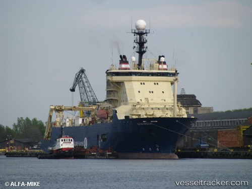
Vessel Ile De Brehat IMO: 9247053, MMSI: 226335000 Cable Layer
UTC, -33.90968, 18.43569, course: 312, speed: 0
UTC, -33.90967, 18.43572, course: 312, speed: 0
2026-02-28 03:28:24 UTC, -33.90969, 18.43567, course: 312, speed: 0
Live AIS position:
UTC. Near Ben Schoeman Dock),
updated 2026-02-28 03:28:24 UTC.
Find the position of the vessel Ile De Brehat on the map. The latter are known coordinates and path.
marine traffic ship tracker show on live map
The current position of vessel Ile De Brehat is -33.90969 lat / 18.43567 lng. Updated: 2026-02-28 03:28:24 UTCDetails:
Last coordinates of the vessel:
UTC, -33.90967, 18.43575, course: 312, speed: 0UTC, -33.90968, 18.43569, course: 312, speed: 0
UTC, -33.90967, 18.43572, course: 312, speed: 0
2026-02-28 03:28:24 UTC, -33.90969, 18.43567, course: 312, speed: 0