 vesseltracker.com
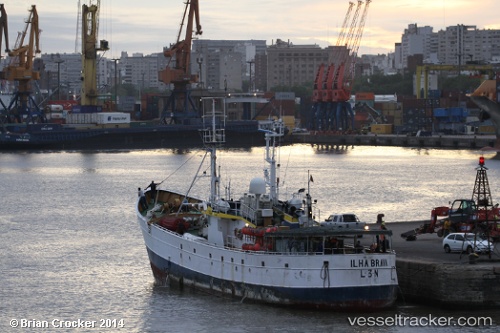
Vessel Ilha Brava IMO: 5158802, MMSI: 263564000 Fishing Vessel
UTC, -39.41702, -42.02534, course: -1, speed: 8.8
UTC, -39.46688, -42.27148, course: -1, speed: 8.7
2026-02-28 19:28:44 UTC, -39.31268, -42.45555, course: -1, speed: 6.5
Live AIS position:
UTC. 342 nm SW of Bernal),
updated 2026-02-28 19:28:44 UTC.
Find the position of the vessel Ilha Brava on the map. The latter are known coordinates and path.
marine traffic ship tracker show on live map
The current position of vessel Ilha Brava is -39.31268 lat / -42.45555 lng. Updated: 2026-02-28 19:28:44 UTCDetails:
Last coordinates of the vessel:
UTC, -39.17509, -41.55469, course: -1, speed: 8.4UTC, -39.41702, -42.02534, course: -1, speed: 8.8
UTC, -39.46688, -42.27148, course: -1, speed: 8.7
2026-02-28 19:28:44 UTC, -39.31268, -42.45555, course: -1, speed: 6.5