 vesseltracker.com
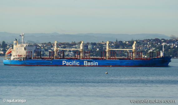
Vessel Illovo River IMO: 9791951, MMSI: 477692900 Bulk Carrier
UTC, 6.84672, 129.14961, course: 20, speed: 10.9
UTC, 7.14161, 129.26273, course: 20, speed: 10.4
2026-03-24 05:18:50 UTC, 7.47444, 129.38608, course: 23, speed: 10.8
Live Vessel Illovo River Analytics (details, animations, etc.)
Live AIS position: UTC. 182 nm E of Boston/Davao), updated 2026-03-24 05:18:50 UTC.Find the position of the vessel Illovo River on the map. The latter are known coordinates and path.
marine traffic ship tracker show on live map
The current position of vessel Illovo River is 7.47444 lat / 129.38608 lng. Updated: 2026-03-24 05:18:50 UTCDetails:
Last coordinates of the vessel:
UTC, 6.44409, 129.00426, course: 20, speed: 10.7UTC, 6.84672, 129.14961, course: 20, speed: 10.9
UTC, 7.14161, 129.26273, course: 20, speed: 10.4
2026-03-24 05:18:50 UTC, 7.47444, 129.38608, course: 23, speed: 10.8