 vesseltracker.com
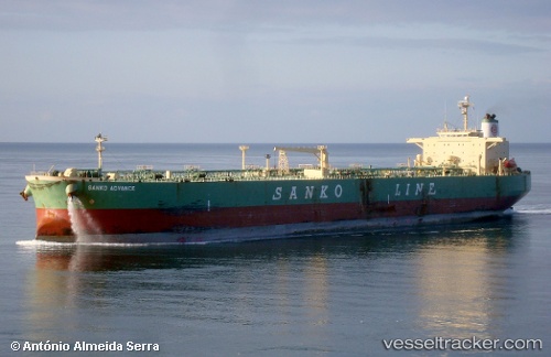
Vessel LOURDES IMO: 9259692, MMSI: 323143000 Crude Oil Tanker
UTC, 20.78280, -75.59175, course: 73, speed: 0
UTC, 20.78280, -75.59175, course: 73, speed: 0
2026-02-23 14:45:25 UTC, 20.78280, -75.59175, course: 73, speed: 0
Live AIS position:
UTC. Near Preston),
updated 2026-02-23 14:45:25 UTC.
Find the position of the vessel LOURDES on the map. The latter are known coordinates and path.
marine traffic ship tracker show on live map
The current position of vessel LOURDES is 20.78280 lat / -75.59175 lng. Updated: 2026-02-23 14:45:25 UTCCurrently sailing under the flag of Cuba
LOURDES built in 2002 year
Deadweight:
84999 tDetails:
Last coordinates of the vessel:
UTC, 20.78280, -75.59177, course: 73, speed: 0UTC, 20.78280, -75.59175, course: 73, speed: 0
UTC, 20.78280, -75.59175, course: 73, speed: 0
2026-02-23 14:45:25 UTC, 20.78280, -75.59175, course: 73, speed: 0