 vesseltracker.com
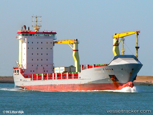
Vessel Imua Ii IMO: 9184237, MMSI: 304887000 Multi Purpose Carrier
UTC, 31.99653, 120.82942, course: 316, speed: 0
UTC, 31.99500, 120.82833, course: -1, speed: 0
2026-02-27 16:06:31 UTC, 31.99638, 120.82950, course: 316, speed: 0
Live AIS position:
UTC. Near Nantong),
updated 2026-02-27 16:06:31 UTC.
Find the position of the vessel Imua Ii on the map. The latter are known coordinates and path.
marine traffic ship tracker show on live map
The current position of vessel Imua Ii is 31.99638 lat / 120.82950 lng. Updated: 2026-02-27 16:06:31 UTCCurrently sailing under the flag of Antigua Barbuda
Details:
Last coordinates of the vessel:
UTC, 31.99643, 120.82947, course: 316, speed: 0UTC, 31.99653, 120.82942, course: 316, speed: 0
UTC, 31.99500, 120.82833, course: -1, speed: 0
2026-02-27 16:06:31 UTC, 31.99638, 120.82950, course: 316, speed: 0