 vesseltracker.com
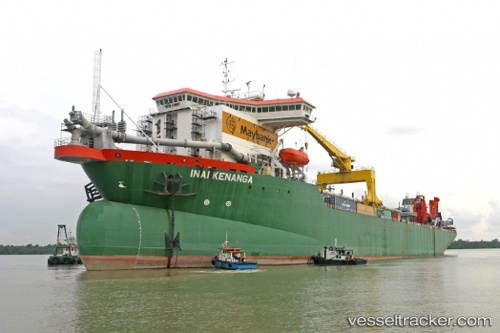
Vessel Inai Kenanga IMO: 9568782, MMSI: 533180137 Hopper Dredger
UTC, 1.51647, 104.02452, course: -1, speed: 0.2
UTC, 1.51686, 104.02444, course: 143, speed: 0
2026-02-27 11:37:14 UTC, 1.51682, 104.02468, course: 170, speed: 0
Live AIS position:
UTC. Near Kampung Tanjung Langsat),
updated 2026-02-27 11:37:14 UTC.
Find the position of the vessel Inai Kenanga on the map. The latter are known coordinates and path.
marine traffic ship tracker show on live map
The current position of vessel Inai Kenanga is 1.51682 lat / 104.02468 lng. Updated: 2026-02-27 11:37:14 UTCCurrently sailing under the flag of Malaysia
Details:
Last coordinates of the vessel:
UTC, 1.51644, 104.02498, course: 20, speed: 0UTC, 1.51647, 104.02452, course: -1, speed: 0.2
UTC, 1.51686, 104.02444, course: 143, speed: 0
2026-02-27 11:37:14 UTC, 1.51682, 104.02468, course: 170, speed: 0