 vesseltracker.com
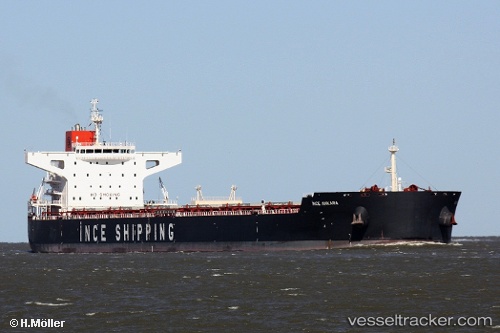
Vessel Ince Ankara IMO: 9481714, MMSI: 563078800 Bulk Carrier
UTC, 58.67256, 32.99948, course: 282, speed: 54.7
UTC, 60.12720, 27.58800, course: 242, speed: 6.3
2026-03-24 05:52:46 UTC, 60.02616, 27.19753, course: 237, speed: 10.6
Live Vessel Ince Ankara Analytics (details, animations, etc.)
Live AIS position: UTC. 26 nm S of Kotka), updated 2026-03-24 05:52:46 UTC.Find the position of the vessel Ince Ankara on the map. The latter are known coordinates and path.
marine traffic ship tracker show on live map
The current position of vessel Ince Ankara is 60.02616 lat / 27.19753 lng. Updated: 2026-03-24 05:52:46 UTCDetails:
Last coordinates of the vessel:
UTC, 57.67149, 32.52902, course: 292, speed: 43.1UTC, 58.67256, 32.99948, course: 282, speed: 54.7
UTC, 60.12720, 27.58800, course: 242, speed: 6.3
2026-03-24 05:52:46 UTC, 60.02616, 27.19753, course: 237, speed: 10.6