 vesseltracker.com
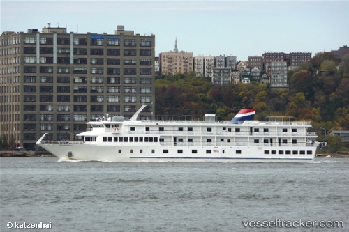
Vessel Independence IMO: 9583366, MMSI: 367438210 Cruise Ship
UTC, 32.69090, -80.22363, course: -1, speed: 0.1
UTC, 32.69090, -80.22363, course: -1, speed: 0.1
2026-02-25 22:34:18 UTC, 32.69090, -80.22363, course: -1, speed: 0.1
Live AIS position:
UTC. Near Meggett),
updated 2026-02-25 22:34:18 UTC.
Find the position of the vessel Independence on the map. The latter are known coordinates and path.
marine traffic ship tracker show on live map
The current position of vessel Independence is 32.69090 lat / -80.22363 lng. Updated: 2026-02-25 22:34:18 UTCDetails:
Last coordinates of the vessel:
UTC, 32.69090, -80.22362, course: -1, speed: 0.1UTC, 32.69090, -80.22363, course: -1, speed: 0.1
UTC, 32.69090, -80.22363, course: -1, speed: 0.1
2026-02-25 22:34:18 UTC, 32.69090, -80.22363, course: -1, speed: 0.1