 vesseltracker.com
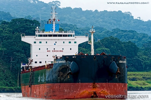
Vessel Indian Harmony IMO: 9626651, MMSI: 636016069 Bulk Carrier
UTC, 1.22143, 88.59135, course: 49, speed: 12.5
UTC, 1.35053, 88.75246, course: -1, speed: 12.5
2026-02-26 11:32:25 UTC, 1.60421, 89.10379, course: 44, speed: 12.5
Live AIS position:
UTC. 339 nm SE of Abakaliki),
updated 2026-02-26 11:32:25 UTC.
Find the position of the vessel Indian Harmony on the map. The latter are known coordinates and path.
marine traffic ship tracker show on live map
The current position of vessel Indian Harmony is 1.60421 lat / 89.10379 lng. Updated: 2026-02-26 11:32:25 UTCCurrently sailing under the flag of Liberia
Indian Harmony built in 2013 year
Deadweight:
76000 tDetails:
Last coordinates of the vessel:
UTC, 0.91381, 88.17777, course: 49, speed: 12.5UTC, 1.22143, 88.59135, course: 49, speed: 12.5
UTC, 1.35053, 88.75246, course: -1, speed: 12.5
2026-02-26 11:32:25 UTC, 1.60421, 89.10379, course: 44, speed: 12.5