 vesseltracker.com
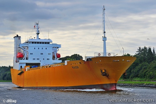
Vessel INDIGO I IMO: 8716966, MMSI: 352001003 Ro-Ro Cargo Ship
UTC, 18.45979, -69.88514, course: 125, speed: 0.3
UTC, 18.45979, -69.88527, course: 117, speed: 0.9
2026-03-17 05:57:32 UTC, 18.46021, -69.88512, course: 133, speed: 0.5
Live Vessel INDIGO I Analytics (details, animations, etc.)
Live AIS position: UTC. Near Santo Domingo), updated 2026-03-17 05:57:32 UTC.Find the position of the vessel INDIGO I on the map. The latter are known coordinates and path.
marine traffic ship tracker show on live map
The current position of vessel INDIGO I is 18.46021 lat / -69.88512 lng. Updated: 2026-03-17 05:57:32 UTCCurrently sailing under the flag of Panama
INDIGO I built in 1990 year
Deadweight:
3956 tDetails:
Last coordinates of the vessel:
UTC, 18.45961, -69.88526, course: 112, speed: 0.8UTC, 18.45979, -69.88514, course: 125, speed: 0.3
UTC, 18.45979, -69.88527, course: 117, speed: 0.9
2026-03-17 05:57:32 UTC, 18.46021, -69.88512, course: 133, speed: 0.5