 vesseltracker.com
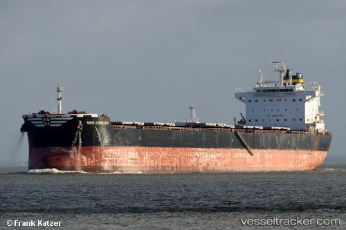
Vessel Ines Corrado IMO: 9602772, MMSI: 311053600 Bulk Carrier
UTC, -23.83167, 151.47833, course: -1, speed: 0
UTC, -23.83167, 151.47833, course: -1, speed: 0
2026-02-25 13:56:32 UTC, -23.83000, 151.47833, course: -1, speed: 0
Live AIS position:
UTC. Near Boyne Island),
updated 2026-02-25 13:56:32 UTC.
Find the position of the vessel Ines Corrado on the map. The latter are known coordinates and path.
marine traffic ship tracker show on live map
The current position of vessel Ines Corrado is -23.83000 lat / 151.47833 lng. Updated: 2026-02-25 13:56:32 UTCCurrently sailing under the flag of Bahamas
Ines Corrado built in 2012 year
Deadweight:
81272 tDetails:
Last coordinates of the vessel:
UTC, -23.83167, 151.47833, course: -1, speed: 0UTC, -23.83167, 151.47833, course: -1, speed: 0
UTC, -23.83167, 151.47833, course: -1, speed: 0
2026-02-25 13:56:32 UTC, -23.83000, 151.47833, course: -1, speed: 0