 vesseltracker.com
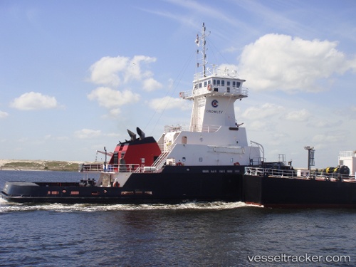
Vessel Integrity IMO: 9369394, MMSI: 368247000 Pusher Tug
UTC, 29.28203, -94.56145, course: 294, speed: 5.1
UTC, 29.34389, -94.70222, course: 282, speed: 12.5
2026-02-26 01:49:32 UTC, 29.70127, -95.00711, course: 275, speed: 10.8
Live AIS position:
UTC. Near Morgan Point),
updated 2026-02-26 01:49:32 UTC.
Find the position of the vessel Integrity on the map. The latter are known coordinates and path.
marine traffic ship tracker show on live map
The current position of vessel Integrity is 29.70127 lat / -95.00711 lng. Updated: 2026-02-26 01:49:32 UTCCurrently sailing under the flag of USA
Integrity built in 2008 year
Deadweight:
822 tDetails:
Last coordinates of the vessel:
UTC, 28.86492, -93.89275, course: 284, speed: 10.4UTC, 29.28203, -94.56145, course: 294, speed: 5.1
UTC, 29.34389, -94.70222, course: 282, speed: 12.5
2026-02-26 01:49:32 UTC, 29.70127, -95.00711, course: 275, speed: 10.8