 vesseltracker.com
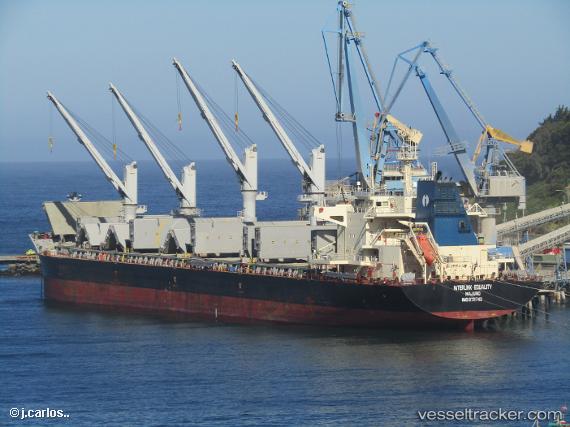
Vessel Interlink Equality IMO: 9711743, MMSI: 538005696 Bulk Carrier
UTC, -29.76829, 31.20410, course: 206, speed: 9.1
UTC, -29.80636, 31.10522, course: 235, speed: 2.7
2026-02-26 01:32:51 UTC, -29.87648, 31.00784, course: 202, speed: 5
Live AIS position:
UTC. Near Umhlatuzana),
updated 2026-02-26 01:32:51 UTC.
Find the position of the vessel Interlink Equality on the map. The latter are known coordinates and path.
marine traffic ship tracker show on live map
The current position of vessel Interlink Equality is -29.87648 lat / 31.00784 lng. Updated: 2026-02-26 01:32:51 UTCDetails:
Last coordinates of the vessel:
UTC, -29.68013, 31.21964, course: 126, speed: 0.2UTC, -29.76829, 31.20410, course: 206, speed: 9.1
UTC, -29.80636, 31.10522, course: 235, speed: 2.7
2026-02-26 01:32:51 UTC, -29.87648, 31.00784, course: 202, speed: 5