 vesseltracker.com
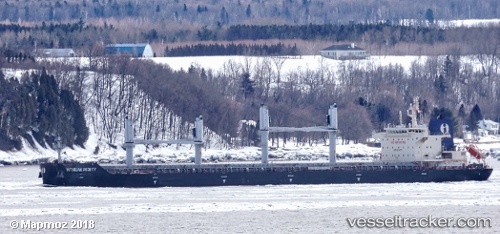
Vessel Interlink Probity IMO: 9714771, MMSI: 538005707 Bulk Carrier
UTC, 22.09333, -72.10500, course: -1, speed: 13
UTC, 22.01333, -72.76333, course: -1, speed: 13
2026-02-25 01:46:01 UTC, 21.97333, -73.14500, course: -1, speed: 13
Live AIS position:
UTC. 21 nm S of Abraham Bay),
updated 2026-02-25 01:46:01 UTC.
Find the position of the vessel Interlink Probity on the map. The latter are known coordinates and path.
marine traffic ship tracker show on live map
The current position of vessel Interlink Probity is 21.97333 lat / -73.14500 lng. Updated: 2026-02-25 01:46:01 UTCCurrently sailing under the flag of Marshall Is
Details:
Last coordinates of the vessel:
UTC, 22.14667, -71.65833, course: -1, speed: 12UTC, 22.09333, -72.10500, course: -1, speed: 13
UTC, 22.01333, -72.76333, course: -1, speed: 13
2026-02-25 01:46:01 UTC, 21.97333, -73.14500, course: -1, speed: 13