 vesseltracker.com
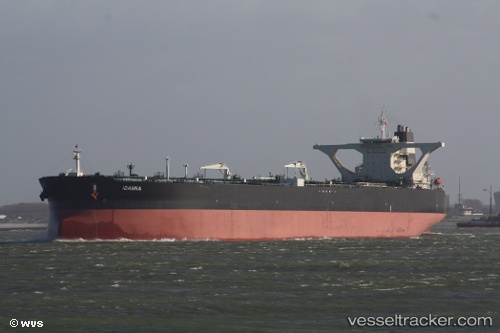
Vessel Ioanna IMO: 9387566, MMSI: 636013373 Crude Oil Tanker
UTC, 22.65895, 69.91123, course: -1, speed: 0
UTC, 22.65875, 69.91160, course: 28, speed: 0
2026-02-25 21:45:41 UTC, 22.66063, 69.91662, course: 264, speed: 0.1
Live AIS position:
UTC. Near Rozi),
updated 2026-02-25 21:45:41 UTC.
Find the position of the vessel Ioanna on the map. The latter are known coordinates and path.
marine traffic ship tracker show on live map
The current position of vessel Ioanna is 22.66063 lat / 69.91662 lng. Updated: 2026-02-25 21:45:41 UTCCurrently sailing under the flag of Liberia
Ioanna built in 2008 year
Deadweight:
318325 tDetails:
Last coordinates of the vessel:
UTC, 22.65780, 69.91533, course: 340, speed: 0.2UTC, 22.65895, 69.91123, course: -1, speed: 0
UTC, 22.65875, 69.91160, course: 28, speed: 0
2026-02-25 21:45:41 UTC, 22.66063, 69.91662, course: 264, speed: 0.1