 vesseltracker.com
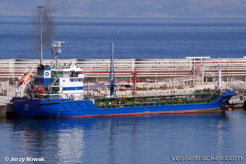
Vessel Ios I IMO: 9460837, MMSI: 229332000 Oil Products Tanker
UTC, 36.13167, -5.36776, course: 290, speed: 0
UTC, 36.10386, -5.35951, course: 356, speed: 0.1
2026-02-25 12:05:57 UTC, 36.10462, -5.36046, course: -1, speed: 0
Live AIS position:
UTC. Near Waterport),
updated 2026-02-25 12:05:57 UTC.
Find the position of the vessel Ios I on the map. The latter are known coordinates and path.
marine traffic ship tracker show on live map
The current position of vessel Ios I is 36.10462 lat / -5.36046 lng. Updated: 2026-02-25 12:05:57 UTCCurrently sailing under the flag of Malta
Ios I built in 2010 year
Deadweight:
4620 tDetails:
Last coordinates of the vessel:
UTC, 36.13125, -5.36848, course: 323, speed: 0.1UTC, 36.13167, -5.36776, course: 290, speed: 0
UTC, 36.10386, -5.35951, course: 356, speed: 0.1
2026-02-25 12:05:57 UTC, 36.10462, -5.36046, course: -1, speed: 0