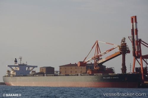
vessel Irene Ii IMO: 9346354, Bulk Carrier
Vessel Irene Ii IMO: 9346354, Bulk Carrier
MMSI: 538005830 callsign: V7HI9 size: 289x45

Find the position of the vessel Irene Ii on the map. The latter are known coordinates and path.

marine traffic ship tracker show on live map

The current position of vessel Irene Ii is -2.54928 lat / -34.4304 lng. Updated: 2024-04-25 00:32:23 UTC

Currently sailing under the flag of Marshall Is

Irene Ii built in 2006 year

Deadweight:
180184 t

Payload_mass:
180184 tonne
Gross tonnage:
90091
Service entry:
2006-01-01T00:00:00Z
Details:


Last coordinates of the vessel:
UTC, -2.25937, -34.731, course: 130, speed: 9.4
UTC, -2.4344, -34.5483, course: 130, speed: 9.3
UTC, -2.49893, -34.4817, course: 131, speed: 9.4
2024-04-25 00:32:23 UTC, -2.54928, -34.4304, course: 132, speed: 9.4

Track of the vessel in the last 14 days


Most frequent ports a vessels calls at Irene Ii (538005830):

Sambu, traffic: 4
Singapore, traffic: 3
Mutrah, traffic: 2
Pohang, traffic: 2
Richards Bay, traffic: 2
Saldanha Bay, traffic: 2
Bohang, traffic: 2
Wu-Sung, traffic: 2
Wusong, traffic: 2
Taicang, traffic: 1
Newcastle, traffic: 1
Fangcheng, traffic: 1
Port Des Galets, traffic: 1
Sitrah Anchorage, traffic: 1
Gladstone Harbor, traffic: 1

Link to the map:


Find another ship

Irene_Ii (538005830) last ports (portcalls and passsages)

Pohang | 2024-02-14 02:58:43
Pohang | 2024-02-10 02:50:54
Lianyungang | 2023-11-25 04:29:34
Fangcheng | 2023-11-15 01:09:31
Sambu | 2023-11-07 07:42:30
Newcastle | 2023-06-03 03:34:58
Gladstone Harbor | 2023-04-20 05:57:30
Wusong | 2023-03-23 06:04:18
Taicang | 2023-03-21 08:08:31
Sambu | 2023-03-04 08:04:29
Saldanha Bay | 2023-02-05 17:41:10
Wusong | 2022-11-15 20:36:08
Saldanha Bay | 2022-10-02 14:03:25
Singapore | 2022-08-15 08:00:45
Sambu | 2022-06-18 04:25:26
Port Des Galets | 2022-06-02 10:05:16
Sitrah Anchorage | 2022-03-23 06:30:12
Mutrah | 2022-03-18 09:55:53
Richards Bay | 2021-12-22 15:52:52