 vesseltracker.com
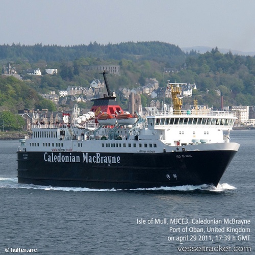
Vessel Isle Of Mull IMO: 8608339, MMSI: 232343000 Passenger Ro Ro Cargo Ship
UTC, 56.47133, -5.70550, course: 244, speed: 0
UTC, 56.42193, -5.56450, course: 250, speed: 15.3
2026-02-17 13:33:59 UTC, 56.07395, -6.14692, course: 240, speed: 14.2
Live AIS position:
UTC. Near Scalasaig, Colonsay),
updated 2026-02-17 13:33:59 UTC.
Find the position of the vessel Isle Of Mull on the map. The latter are known coordinates and path.
marine traffic ship tracker show on live map
The current position of vessel Isle Of Mull is 56.07395 lat / -6.14692 lng. Updated: 2026-02-17 13:33:59 UTCCurrently sailing under the flag of United Kingdom
Isle Of Mull built in 1988 year
Deadweight:
451 tDetails:
Last coordinates of the vessel:
UTC, 56.41225, -5.47690, course: 16, speed: 0UTC, 56.47133, -5.70550, course: 244, speed: 0
UTC, 56.42193, -5.56450, course: 250, speed: 15.3
2026-02-17 13:33:59 UTC, 56.07395, -6.14692, course: 240, speed: 14.2