 vesseltracker.com
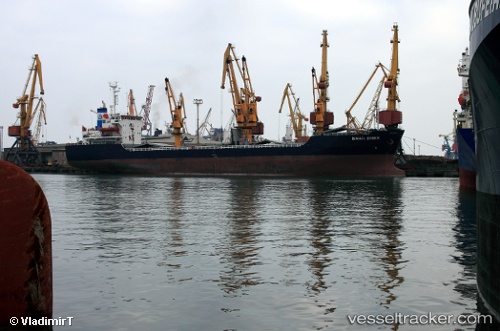
Vessel LADY JAMILA IMO: 8606109, MMSI: 511100861 General Cargo
UTC, 45.12743, 33.01403, course: 0, speed: 52.6
UTC, 45.53590, 32.80172, course: 305, speed: 54.1
2026-03-17 00:28:50 UTC, 45.53590, 32.80172, course: 305, speed: 54.1
Live Vessel LADY JAMILA Analytics (details, animations, etc.)
Live AIS position: UTC. 32 nm NW of Yevpatoriia), updated 2026-03-17 00:28:50 UTC.Find the position of the vessel LADY JAMILA on the map. The latter are known coordinates and path.
marine traffic ship tracker show on live map
The current position of vessel LADY JAMILA is 45.53590 lat / 32.80172 lng. Updated: 2026-03-17 00:28:50 UTCCurrently sailing under the flag of Palau
Details:
Last coordinates of the vessel:
UTC, 44.92790, 29.98045, course: 7, speed: 0.1UTC, 45.12743, 33.01403, course: 0, speed: 52.6
UTC, 45.53590, 32.80172, course: 305, speed: 54.1
2026-03-17 00:28:50 UTC, 45.53590, 32.80172, course: 305, speed: 54.1