 vesseltracker.com
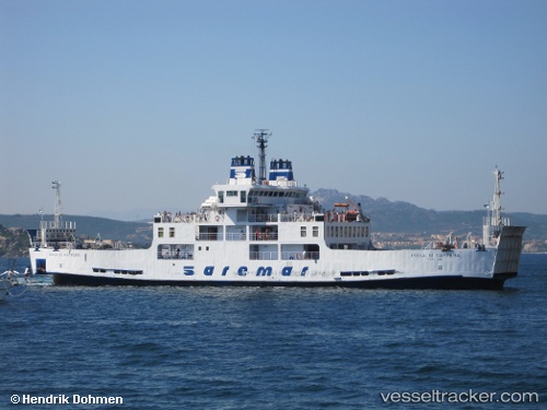
Vessel Isola Di Capraia IMO: 9166182, MMSI: 247388000 Passenger Ro Ro Cargo Ship
UTC, 42.00475, 15.00349, course: 147, speed: 0
UTC, 42.00475, 15.00349, course: 147, speed: 0
2026-02-25 07:43:33 UTC, 42.04083, 15.24893, course: 73, speed: 21.6
Live AIS position:
UTC. 11 nm NE of Campomarino),
updated 2026-02-25 07:43:33 UTC.
Find the position of the vessel Isola Di Capraia on the map. The latter are known coordinates and path.
marine traffic ship tracker show on live map
The current position of vessel Isola Di Capraia is 42.04083 lat / 15.24893 lng. Updated: 2026-02-25 07:43:33 UTCCurrently sailing under the flag of Italy
Isola Di Capraia built in 1999 year
Deadweight:
200 tDetails:
Last coordinates of the vessel:
UTC, 42.00476, 15.00350, course: 147, speed: 0UTC, 42.00475, 15.00349, course: 147, speed: 0
UTC, 42.00475, 15.00349, course: 147, speed: 0
2026-02-25 07:43:33 UTC, 42.04083, 15.24893, course: 73, speed: 21.6