 vesseltracker.com
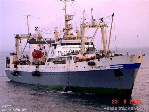
Vessel Ivan Kalinin IMO: 8721179, MMSI: 273878100 Fishing Vessel
UTC, 51.06500, 156.16667, course: -1, speed: 10
UTC, 50.77333, 156.67000, course: -1, speed: 9
2026-01-30 21:38:00 UTC, 50.54590, 156.90878, course: 149, speed: 11.2
Live AIS position:
UTC. 30 nm E of Severo-Kurilsk),
updated 2026-01-30 21:38:00 UTC.
Find the position of the vessel Ivan Kalinin on the map. The latter are known coordinates and path.
marine traffic ship tracker show on live map
The current position of vessel Ivan Kalinin is 50.54590 lat / 156.90878 lng. Updated: 2026-01-30 21:38:00 UTCDetails:
Last coordinates of the vessel:
UTC, 51.10167, 156.09500, course: -1, speed: 3UTC, 51.06500, 156.16667, course: -1, speed: 10
UTC, 50.77333, 156.67000, course: -1, speed: 9
2026-01-30 21:38:00 UTC, 50.54590, 156.90878, course: 149, speed: 11.2