 vesseltracker.com
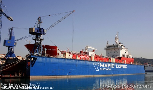
Vessel IVER BEST IMO: 9588275, MMSI: 255916096 Asphalt/Bitumen Tanker
UTC, 36.06573, -5.32935, course: 271, speed: 9.5
UTC, 36.17710, -5.40015, course: 83, speed: 0.1
2026-03-17 03:23:18 UTC, 36.17709, -5.40018, course: 83, speed: 0
Live Vessel IVER BEST Analytics (details, animations, etc.)
Live AIS position: UTC. Near CARTEYA GUADARRANQUE), updated 2026-03-17 03:23:18 UTC.Find the position of the vessel IVER BEST on the map. The latter are known coordinates and path.
marine traffic ship tracker show on live map
The current position of vessel IVER BEST is 36.17709 lat / -5.40018 lng. Updated: 2026-03-17 03:23:18 UTCCurrently sailing under the flag of Portugal
Details:
Last coordinates of the vessel:
UTC, 36.17081, -5.11277, course: 225, speed: 11.1UTC, 36.06573, -5.32935, course: 271, speed: 9.5
UTC, 36.17710, -5.40015, course: 83, speed: 0.1
2026-03-17 03:23:18 UTC, 36.17709, -5.40018, course: 83, speed: 0