 vesseltracker.com
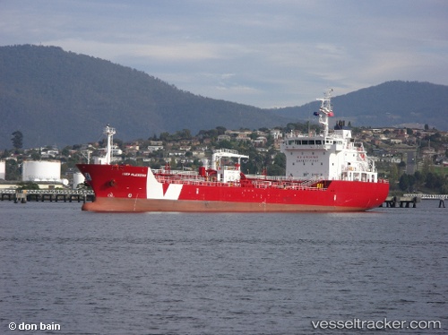
Vessel Iver Blessing IMO: 9588287, MMSI: 236623000 Bitumen Tanker
UTC, 37.21440, 15.19869, course: 119, speed: 0.1
UTC, 37.21310, 15.19911, course: 41, speed: 0.1
2026-03-17 03:47:17 UTC, 37.21313, 15.19896, course: 50, speed: 0.1
Live Vessel Iver Blessing Analytics (details, animations, etc.)
Live AIS position: UTC. Near Punta Cugno), updated 2026-03-17 03:47:17 UTC.Find the position of the vessel Iver Blessing on the map. The latter are known coordinates and path.
marine traffic ship tracker show on live map
The current position of vessel Iver Blessing is 37.21313 lat / 15.19896 lng. Updated: 2026-03-17 03:47:17 UTCCurrently sailing under the flag of Gibraltar
Iver Blessing built in 2011 year
Deadweight:
6189 tDetails:
Last coordinates of the vessel:
UTC, 37.21372, 15.19874, course: -1, speed: 0UTC, 37.21440, 15.19869, course: 119, speed: 0.1
UTC, 37.21310, 15.19911, course: 41, speed: 0.1
2026-03-17 03:47:17 UTC, 37.21313, 15.19896, course: 50, speed: 0.1