 vesseltracker.com
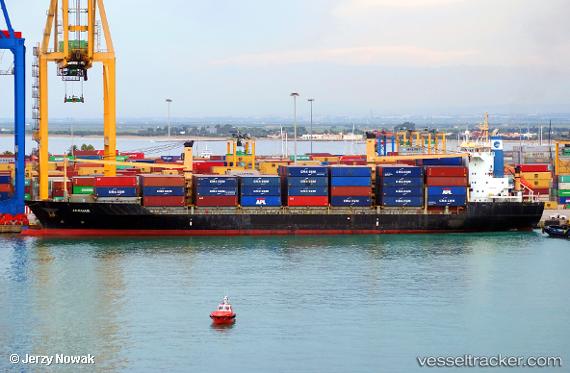
Vessel JAGUAR IMO: 9127007, MMSI: 636021184 Container Ship
UTC, 38.59076, 24.98065, course: 205, speed: 11
UTC, 38.11234, 24.69102, course: -1, speed: 10.9
2026-03-03 04:19:13 UTC, 37.80437, 24.39121, course: -1, speed: 11.2
Live AIS position:
UTC. Near KEA),
updated 2026-03-03 04:19:13 UTC.
Find the position of the vessel JAGUAR on the map. The latter are known coordinates and path.
marine traffic ship tracker show on live map
The current position of vessel JAGUAR is 37.80437 lat / 24.39121 lng. Updated: 2026-03-03 04:19:13 UTCCurrently sailing under the flag of Liberia
Details:
Last coordinates of the vessel:
UTC, 38.84703, 25.13870, course: -1, speed: 11UTC, 38.59076, 24.98065, course: 205, speed: 11
UTC, 38.11234, 24.69102, course: -1, speed: 10.9
2026-03-03 04:19:13 UTC, 37.80437, 24.39121, course: -1, speed: 11.2