 vesseltracker.com
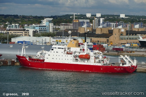
Vessel NOOSFERA IMO: 8904496, MMSI: 272183900 Research Vessel
UTC, -67.58626, -68.13325, course: 40, speed: 0
UTC, -67.58624, -68.13333, course: 15, speed: 0
2026-03-09 15:43:02 UTC, -67.57625, -68.13182, course: 10, speed: 1.4
Live Vessel NOOSFERA Analytics (details, animations, etc.)
Live AIS position: UTC. Near Rothera), updated 2026-03-09 15:43:02 UTC.Find the position of the vessel NOOSFERA on the map. The latter are known coordinates and path.
marine traffic ship tracker show on live map
The current position of vessel NOOSFERA is -67.57625 lat / -68.13182 lng. Updated: 2026-03-09 15:43:02 UTCCurrently sailing under the flag of Ukraine
NOOSFERA built in 1991 year
Deadweight:
2917 tDetails:
Last coordinates of the vessel:
UTC, -67.61948, -68.07761, course: 129, speed: 0UTC, -67.58626, -68.13325, course: 40, speed: 0
UTC, -67.58624, -68.13333, course: 15, speed: 0
2026-03-09 15:43:02 UTC, -67.57625, -68.13182, course: 10, speed: 1.4