 vesseltracker.com
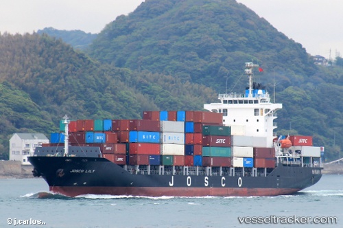
Vessel 413281350 IMO: 9342671, MMSI: 413281350
UTC, 33.16882, 135.70665, course: 59, speed: 17.1
UTC, 33.30667, 136.04832, course: -1, speed: 16
2026-01-29 08:02:07 UTC, 33.61667, 136.71832, course: -1, speed: 14
Live AIS position:
UTC. 41 nm S of HAMAJIMA),
updated 2026-01-29 08:02:07 UTC.
Find the position of the vessel 413281350 on the map. The latter are known coordinates and path.
marine traffic ship tracker show on live map
The current position of vessel 413281350 is 33.61667 lat / 136.71832 lng. Updated: 2026-01-29 08:02:07 UTCDetails:
Last coordinates of the vessel:
UTC, 32.89167, 134.97166, course: -1, speed: 16UTC, 33.16882, 135.70665, course: 59, speed: 17.1
UTC, 33.30667, 136.04832, course: -1, speed: 16
2026-01-29 08:02:07 UTC, 33.61667, 136.71832, course: -1, speed: 14