vessel 'RYUJIN NAKIRA' IMO: 9208069, vesseltracker.com
Vessel 'RYUJIN NAKIRA' IMO: 9208069,
MMSI: 372839000 callsign: size: x

Find the position of the vessel 'RYUJIN NAKIRA' on the map. The latter are known coordinates and path.

marine traffic ship tracker show on live map

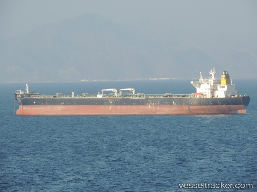
The current position of vessel 'RYUJIN NAKIRA' is 12.0424 lat / 45.6324 lng. Updated: 2024-04-26 16:17:08 UTC
Payload_mass:
147080 tonne
Gross tonnage:
80870
Service entry:
2000-01-01T00:00:00Z
Details:


Last coordinates of the vessel:
UTC, 11.845, 44.985, course: -1, speed: 10
UTC, 11.8803, 45.1469, course: 74, speed: 11.1
UTC, 11.9541, 45.3692, course: 73, speed: 11.1
2024-04-26 16:17:08 UTC, 12.0424, 45.6324, course: 74, speed: 11.3

Track of the vessel in the last 14 days


Most frequent ports a vessels calls at 'RYUJIN NAKIRA' (372839000):

Sambu, traffic: 24
Singapore, traffic: 15
Port Louis, traffic: 1

Link to the map:


Find another ship

'RYUJIN_NAKIRA' (372839000) last ports (portcalls and passsages)

Singapore | 2023-12-08 22:50:52
Sambu | 2022-10-02 16:32:59
Port Louis | 2022-06-21 07:13:49
Singapore | 2022-06-07 14:04:02
Singapore | 2022-01-17 03:55:41
Singapore | 2022-01-17 03:15:21
Sambu | 2022-01-17 03:05:11
Sambu | 2022-01-17 03:00:11
Singapore | 2022-01-17 02:55:10
Sambu | 2022-01-16 12:15:30
Sambu | 2022-01-16 04:40:39
Sambu | 2022-01-16 02:50:11
Singapore | 2022-01-16 02:40:41
Sambu | 2022-01-16 02:37:52