 vesseltracker.com
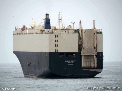
Vessel K. ASIAN BEAUTY IMO: 9070462, MMSI: 441357000 Vehicles Carrier
UTC, 47.26085, -122.38244, course: 313, speed: 0
UTC, 47.26085, -122.38244, course: 313, speed: 0
2026-02-23 01:59:15 UTC, 47.26087, -122.38241, course: 313, speed: 0
Live AIS position:
UTC. Near Tacoma),
updated 2026-02-23 01:59:15 UTC.
Find the position of the vessel K. ASIAN BEAUTY on the map. The latter are known coordinates and path.
marine traffic ship tracker show on live map
The current position of vessel K. ASIAN BEAUTY is 47.26087 lat / -122.38241 lng. Updated: 2026-02-23 01:59:15 UTCCurrently sailing under the flag of Korea (Republic of)
K. ASIAN BEAUTY built in 1994 year
Deadweight:
13308 tDetails:
Last coordinates of the vessel:
UTC, 47.26084, -122.38242, course: 313, speed: 0UTC, 47.26085, -122.38244, course: 313, speed: 0
UTC, 47.26085, -122.38244, course: 313, speed: 0
2026-02-23 01:59:15 UTC, 47.26087, -122.38241, course: 313, speed: 0