 vesseltracker.com
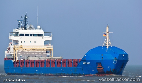
Vessel KAARI IMO: 9434761, MMSI: 305342000 General Cargo
UTC, 55.31500, 19.34833, course: -1, speed: 10
UTC, 55.31500, 19.34833, course: -1, speed: 10
2026-01-31 10:02:12 UTC, 56.26246, 20.10034, course: 33, speed: 10.5
Live AIS position:
UTC. 33 nm W of Nica),
updated 2026-01-31 10:02:12 UTC.
ex Ameland
Find the position of the vessel KAARI on the map. The latter are known coordinates and path.
marine traffic ship tracker show on live map
The current position of vessel KAARI is 56.26246 lat / 20.10034 lng. Updated: 2026-01-31 10:02:12 UTCCurrently sailing under the flag of Antigua Barbuda
KAARI built in 2009 year
Deadweight:
6390 tDetails:
ex Ameland
Last coordinates of the vessel:
UTC, 54.93867, 19.11402, course: 28, speed: 10UTC, 55.31500, 19.34833, course: -1, speed: 10
UTC, 55.31500, 19.34833, course: -1, speed: 10
2026-01-31 10:02:12 UTC, 56.26246, 20.10034, course: 33, speed: 10.5