 vesseltracker.com
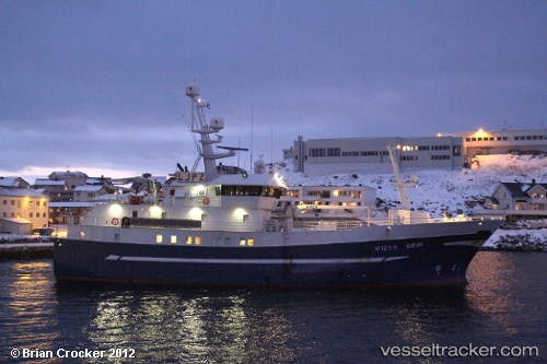
Vessel KAMBUR IMO: 8943600, MMSI: 231795000 Fishing Vessel
Live AIS position:
UTC. 20 nm S of Vágur),
updated 2024-02-06 06:56:15 UTC.
Find the position of the vessel KAMBUR on the map. The latter are known coordinates and path.
marine traffic ship tracker show on live map
The current position of vessel KAMBUR is 61.13365 lat / -6.92003 lng. Updated: 2024-02-06 06:56:15 UTCCurrently sailing under the flag of Faroe Islands
KAMBUR built in 1998 year
Deadweight:
0 tDetails:
Last coordinates of the vessel:
2024-02-06 06:56:15 UTC, 61.13365, -6.92003, course: -1, speed: 1.4