 vesseltracker.com
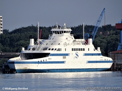
Vessel KAMUTIK W IMO: 9481805, MMSI: 316040593 Passenger/Ro-Ro Ship (vehicles)
UTC, 51.20439, -56.77326, course: 271, speed: 0
UTC, 51.20500, -56.77333, course: -1, speed: 0
2026-01-30 07:18:55 UTC, 51.20500, -56.77333, course: -1, speed: 0
Live AIS position:
UTC. 19 nm SE of Blanc-Sablon),
updated 2026-01-30 07:18:55 UTC.
Find the position of the vessel KAMUTIK W on the map. The latter are known coordinates and path.
marine traffic ship tracker show on live map
The current position of vessel KAMUTIK W is 51.20500 lat / -56.77333 lng. Updated: 2026-01-30 07:18:55 UTCCurrently sailing under the flag of Canada
KAMUTIK W built in 2011 year
Deadweight:
900 tDetails:
Last coordinates of the vessel:
UTC, 51.20500, -56.77333, course: -1, speed: 0UTC, 51.20439, -56.77326, course: 271, speed: 0
UTC, 51.20500, -56.77333, course: -1, speed: 0
2026-01-30 07:18:55 UTC, 51.20500, -56.77333, course: -1, speed: 0