 vesseltracker.com
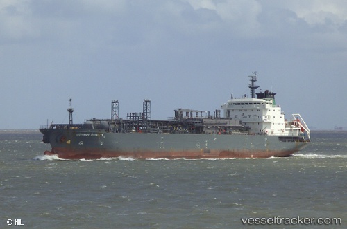
Vessel KANHA IMO: 9155341, MMSI: 626209000 LPG Tanker
Live AIS position:
UTC. Near KHORFAKKAN),
updated 2024-12-07 05:22:56 UTC.
Find the position of the vessel KANHA on the map. The latter are known coordinates and path.
marine traffic ship tracker show on live map
The current position of vessel KANHA is 25.39954 lat / 56.51415 lng. Updated: 2024-12-07 05:22:56 UTCCurrently sailing under the flag of Gabon
KANHA built in 1998 year
Deadweight:
18111 tDetails:
Last coordinates of the vessel:
2024-12-07 05:22:56 UTC, 25.39954, 56.51415, course: 29, speed: 0.1