 vesseltracker.com
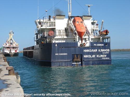
Vessel KARELIS 71 IMO: 9383883, MMSI: 341650000 General Cargo Ship
UTC, 45.06199, 36.60032, course: 44, speed: 7.6
UTC, 45.30664, 36.46817, course: 62, speed: 49.7
2026-02-02 11:38:25 UTC, 45.30664, 36.46817, course: 62, speed: 49.7
Live AIS position:
UTC. Near KOMYSH BURUNSKA),
updated 2026-02-02 11:38:25 UTC.
Find the position of the vessel KARELIS 71 on the map. The latter are known coordinates and path.
marine traffic ship tracker show on live map
The current position of vessel KARELIS 71 is 45.30664 lat / 36.46817 lng. Updated: 2026-02-02 11:38:25 UTCCurrently sailing under the flag of St.Kitts and Nevis
KARELIS 71 built in 2006 year
Deadweight:
6882 tDetails:
Last coordinates of the vessel:
UTC, 45.05965, 36.60188, course: 57, speed: 10.6UTC, 45.06199, 36.60032, course: 44, speed: 7.6
UTC, 45.30664, 36.46817, course: 62, speed: 49.7
2026-02-02 11:38:25 UTC, 45.30664, 36.46817, course: 62, speed: 49.7