 vesseltracker.com
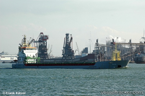
Vessel KETTER IMO: 9195860, MMSI: 229344000 General Cargo
UTC, 51.78397, 3.34246, course: 117, speed: 0.1
UTC, 51.78170, 3.34201, course: 62, speed: 0.1
2026-01-22 19:08:14 UTC, 51.78361, 3.34240, course: 97, speed: 0.2
Live AIS position:
UTC. Near Hunsdon),
updated 2026-01-22 19:08:14 UTC.
ex Taha
Find the position of the vessel KETTER on the map. The latter are known coordinates and path.
marine traffic ship tracker show on live map
The current position of vessel KETTER is 51.78361 lat / 3.34240 lng. Updated: 2026-01-22 19:08:14 UTCCurrently sailing under the flag of Malta
KETTER built in 2000 year
Deadweight:
5050 tDetails:
ex Taha
Last coordinates of the vessel:
UTC, 51.78296, 3.34175, course: 72, speed: 0.1UTC, 51.78397, 3.34246, course: 117, speed: 0.1
UTC, 51.78170, 3.34201, course: 62, speed: 0.1
2026-01-22 19:08:14 UTC, 51.78361, 3.34240, course: 97, speed: 0.2