 vesseltracker.com
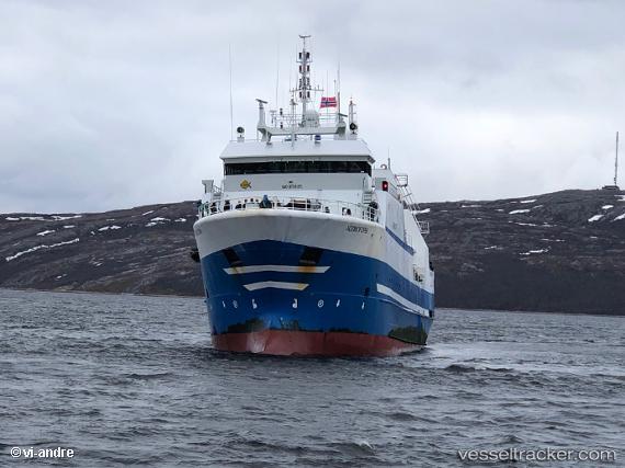
Vessel KHOLMOGORY IMO: 9158185, MMSI: 273326830 Fishing Vessel
UTC, 70.01986, 43.01933, course: 48, speed: 4.2
UTC, 70.05081, 43.22903, course: 50, speed: 8.7
2026-02-21 05:26:30 UTC, 70.00565, 43.07149, course: 194, speed: 4.2
Live AIS position:
UTC. 139 nm NW of Kolguyev Island),
updated 2026-02-21 05:26:30 UTC.
Find the position of the vessel KHOLMOGORY on the map. The latter are known coordinates and path.
marine traffic ship tracker show on live map
The current position of vessel KHOLMOGORY is 70.00565 lat / 43.07149 lng. Updated: 2026-02-21 05:26:30 UTCCurrently sailing under the flag of Russia
KHOLMOGORY built in 1998 year
Deadweight:
1025 tDetails:
Last coordinates of the vessel:
UTC, 69.90667, 43.00667, course: -1, speed: 1UTC, 70.01986, 43.01933, course: 48, speed: 4.2
UTC, 70.05081, 43.22903, course: 50, speed: 8.7
2026-02-21 05:26:30 UTC, 70.00565, 43.07149, course: 194, speed: 4.2