 vesseltracker.com
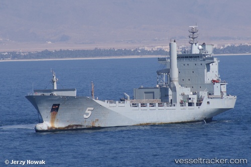
Vessel Ka Bunga Mas 5 IMO: 9121675, MMSI: 533167000 Service Ship
UTC, 6.08574, 116.11428, course: -1, speed: 0
UTC, 6.08573, 116.11426, course: -1, speed: 0
2026-01-31 15:46:04 UTC, 6.08575, 116.11428, course: -1, speed: 0
Live AIS position:
UTC. Near Kota Kinabalu),
updated 2026-01-31 15:46:04 UTC.
Find the position of the vessel Ka Bunga Mas 5 on the map. The latter are known coordinates and path.
marine traffic ship tracker show on live map
The current position of vessel Ka Bunga Mas 5 is 6.08575 lat / 116.11428 lng. Updated: 2026-01-31 15:46:04 UTCCurrently sailing under the flag of Malaysia
Ka Bunga Mas 5 built in 1997 year
Deadweight:
8991 tDetails:
Last coordinates of the vessel:
UTC, 6.08573, 116.11423, course: -1, speed: 0UTC, 6.08574, 116.11428, course: -1, speed: 0
UTC, 6.08573, 116.11426, course: -1, speed: 0
2026-01-31 15:46:04 UTC, 6.08575, 116.11428, course: -1, speed: 0