 vesseltracker.com
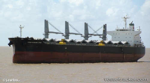
Vessel Kacey IMO: 9420277, MMSI: 538005725 Bulk Carrier
UTC, 34.71500, 21.69667, course: -1, speed: 10
UTC, 34.84667, 21.08333, course: -1, speed: 10
2026-01-31 08:21:41 UTC, 34.84667, 21.08333, course: -1, speed: 10
Live AIS position:
UTC. 121 nm SW of Kythira),
updated 2026-01-31 08:21:41 UTC.
Find the position of the vessel Kacey on the map. The latter are known coordinates and path.
marine traffic ship tracker show on live map
The current position of vessel Kacey is 34.84667 lat / 21.08333 lng. Updated: 2026-01-31 08:21:41 UTCDetails:
Last coordinates of the vessel:
UTC, 34.64411, 22.06285, course: 285, speed: 10.9UTC, 34.71500, 21.69667, course: -1, speed: 10
UTC, 34.84667, 21.08333, course: -1, speed: 10
2026-01-31 08:21:41 UTC, 34.84667, 21.08333, course: -1, speed: 10