 vesseltracker.com
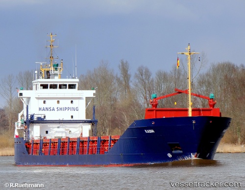
Vessel Kadri IMO: 9114725, MMSI: 256341000 Deck Cargo Ship
Live AIS position:
UTC. Near KRONSHTADT),
updated 2024-08-31 18:34:36 UTC.
Find the position of the vessel Kadri on the map. The latter are known coordinates and path.
marine traffic ship tracker show on live map
The current position of vessel Kadri is 59.97446 lat / 29.77218 lng. Updated: 2024-08-31 18:34:36 UTCCurrently sailing under the flag of Malta
Kadri built in 1995 year
Deadweight:
4506 tDetails:
Last coordinates of the vessel:
2024-08-31 18:34:36 UTC, 59.97446, 29.77218, course: 315, speed: 10.9