 vesseltracker.com
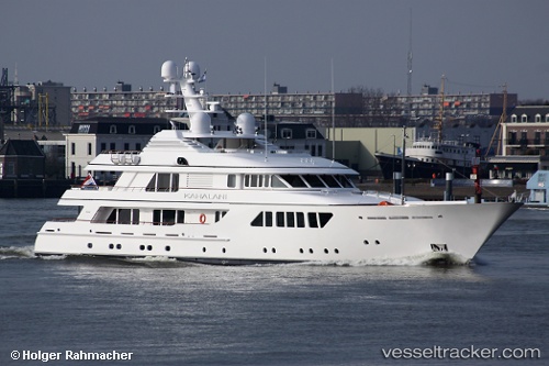
Vessel Kahalani IMO: 1010430, MMSI: 248232000 Service Ship
UTC, 52.42598, 4.83700, course: 163, speed: 0
UTC, 52.42597, 4.83700, course: 163, speed: 0
2026-01-31 07:28:37 UTC, 52.42596, 4.83701, course: 163, speed: 0
Live AIS position:
UTC. Near ZAANDAM),
updated 2026-01-31 07:28:37 UTC.
Find the position of the vessel Kahalani on the map. The latter are known coordinates and path.
marine traffic ship tracker show on live map
The current position of vessel Kahalani is 52.42596 lat / 4.83701 lng. Updated: 2026-01-31 07:28:37 UTCCurrently sailing under the flag of Malta
Kahalani built in 2010 year
Details:
Last coordinates of the vessel:
UTC, 52.42500, 4.83667, course: -1, speed: 0UTC, 52.42598, 4.83700, course: 163, speed: 0
UTC, 52.42597, 4.83700, course: 163, speed: 0
2026-01-31 07:28:37 UTC, 52.42596, 4.83701, course: 163, speed: 0