 vesseltracker.com
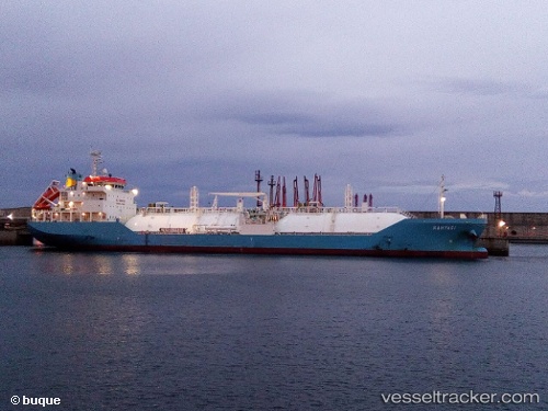
Vessel Kahyasi IMO: 9726815, MMSI: 566478000 Lpg Tanker
UTC, -6.84333, 39.29833, course: -1, speed: 0
UTC, -6.84333, 39.29833, course: -1, speed: 0
2026-02-01 04:11:38 UTC, -6.75245, 39.35421, course: 60, speed: 12.4
Live AIS position:
UTC. Near Dar es Salaam),
updated 2026-02-01 04:11:38 UTC.
Find the position of the vessel Kahyasi on the map. The latter are known coordinates and path.
marine traffic ship tracker show on live map
The current position of vessel Kahyasi is -6.75245 lat / 39.35421 lng. Updated: 2026-02-01 04:11:38 UTCDetails:
Last coordinates of the vessel:
UTC, -6.84333, 39.29833, course: -1, speed: 0UTC, -6.84333, 39.29833, course: -1, speed: 0
UTC, -6.84333, 39.29833, course: -1, speed: 0
2026-02-01 04:11:38 UTC, -6.75245, 39.35421, course: 60, speed: 12.4