 vesseltracker.com
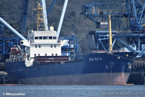
Vessel Kai Ze 6 IMO: 9577018, MMSI: 312987000 General Cargo Ship
UTC, 1.15938, 103.97013, course: -1, speed: 0.1
UTC, 1.15937, 103.97015, course: -1, speed: 0.2
2026-01-31 15:52:31 UTC, 1.15926, 103.97037, course: -1, speed: 0.1
Live AIS position:
UTC. Near BATU AMPAR),
updated 2026-01-31 15:52:31 UTC.
Find the position of the vessel Kai Ze 6 on the map. The latter are known coordinates and path.
marine traffic ship tracker show on live map
The current position of vessel Kai Ze 6 is 1.15926 lat / 103.97037 lng. Updated: 2026-01-31 15:52:31 UTCDetails:
Last coordinates of the vessel:
UTC, 1.15945, 103.97005, course: -1, speed: 0.3UTC, 1.15938, 103.97013, course: -1, speed: 0.1
UTC, 1.15937, 103.97015, course: -1, speed: 0.2
2026-01-31 15:52:31 UTC, 1.15926, 103.97037, course: -1, speed: 0.1