 vesseltracker.com
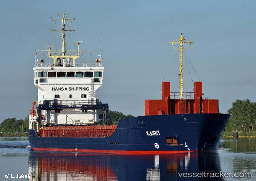
Vessel Kairit IMO: 9195949, MMSI: 229241000 Multi Purpose Carrier
Live AIS position:
UTC. Near Bullu),
updated 2024-11-01 05:05:13 UTC.
Find the position of the vessel Kairit on the map. The latter are known coordinates and path.
marine traffic ship tracker show on live map
The current position of vessel Kairit is 57.02675 lat / 24.08318 lng. Updated: 2024-11-01 05:05:13 UTCCurrently sailing under the flag of Malta
Kairit built in 2000 year
Deadweight:
4956 tDetails:
Last coordinates of the vessel:
2024-11-01 05:05:13 UTC, 57.02675, 24.08318, course: 165, speed: 0