 vesseltracker.com
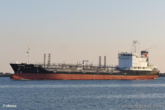
Vessel Kaiseimaru IMO: 9816062, MMSI: 431010742 Oil Products Tanker
UTC, 37.01492, 141.08691, course: 185, speed: 13.4
UTC, 36.56424, 141.03633, course: 187, speed: 13.1
2026-01-29 22:19:35 UTC, 36.12675, 140.98727, course: 183, speed: 13.8
Live AIS position:
UTC. 16 nm NE of Kashima Ko),
updated 2026-01-29 22:19:35 UTC.
Find the position of the vessel Kaiseimaru on the map. The latter are known coordinates and path.
marine traffic ship tracker show on live map
The current position of vessel Kaiseimaru is 36.12675 lat / 140.98727 lng. Updated: 2026-01-29 22:19:35 UTCDetails:
Last coordinates of the vessel:
UTC, 37.57394, 141.15147, course: 187, speed: 13.3UTC, 37.01492, 141.08691, course: 185, speed: 13.4
UTC, 36.56424, 141.03633, course: 187, speed: 13.1
2026-01-29 22:19:35 UTC, 36.12675, 140.98727, course: 183, speed: 13.8