 vesseltracker.com
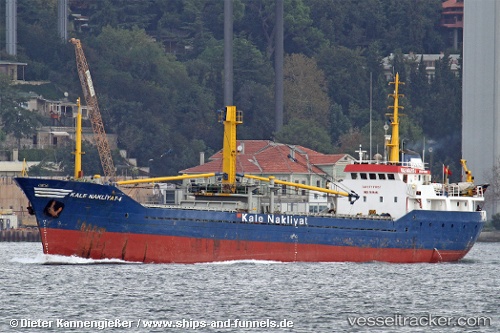
Vessel Kale Nakliyat 4 IMO: 6919693, MMSI: 271002259 General Cargo Ship
UTC, 40.41241, 29.08147, course: -1, speed: 0
UTC, 40.41241, 29.08144, course: -1, speed: 0
2026-01-29 21:41:00 UTC, 40.41240, 29.08149, course: -1, speed: 0
Live AIS position:
UTC. Near GEMLIK),
updated 2026-01-29 21:41:00 UTC.
Find the position of the vessel Kale Nakliyat 4 on the map. The latter are known coordinates and path.
marine traffic ship tracker show on live map
The current position of vessel Kale Nakliyat 4 is 40.41240 lat / 29.08149 lng. Updated: 2026-01-29 21:41:00 UTCDetails:
Last coordinates of the vessel:
UTC, 40.41241, 29.08149, course: -1, speed: 0UTC, 40.41241, 29.08147, course: -1, speed: 0
UTC, 40.41241, 29.08144, course: -1, speed: 0
2026-01-29 21:41:00 UTC, 40.41240, 29.08149, course: -1, speed: 0