 vesseltracker.com
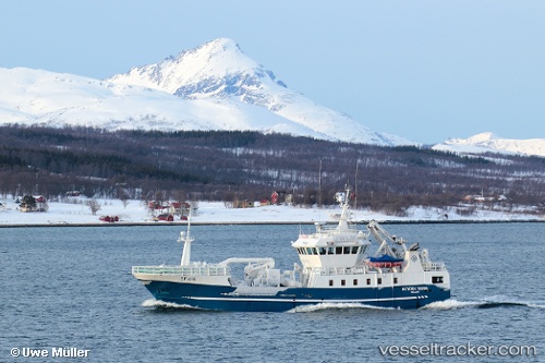
Vessel Kamilla G IMO: 9397004, MMSI: 257149000 Fishing Vessel
UTC, 62.20364, 5.57159, course: 128, speed: 0
UTC, 62.20363, 5.57156, course: 128, speed: 0
2026-01-28 06:15:12 UTC, 62.20365, 5.57152, course: 128, speed: 0
Live AIS position:
UTC. Near Larsnes),
updated 2026-01-28 06:15:12 UTC.
Find the position of the vessel Kamilla G on the map. The latter are known coordinates and path.
marine traffic ship tracker show on live map
The current position of vessel Kamilla G is 62.20365 lat / 5.57152 lng. Updated: 2026-01-28 06:15:12 UTCCurrently sailing under the flag of Norway
Kamilla G built in 2006 year
Details:
Last coordinates of the vessel:
UTC, 62.20352, 5.57130, course: 128, speed: 0UTC, 62.20364, 5.57159, course: 128, speed: 0
UTC, 62.20363, 5.57156, course: 128, speed: 0
2026-01-28 06:15:12 UTC, 62.20365, 5.57152, course: 128, speed: 0