 vesseltracker.com
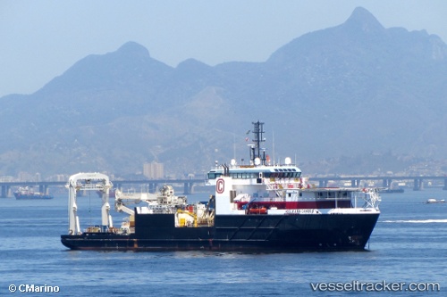
Vessel Kelly Ann Candies IMO: 9562427, MMSI: 367431830 Offshore Support Vessel
UTC, 29.13089, -90.19466, course: 163, speed: 0
UTC, 29.13093, -90.19465, course: 163, speed: 0
UTC, 29.13096, -90.19462, course: 163, speed: 0
2026-01-23 01:39:58 UTC, 29.13096, -90.19462, course: 163, speed: 0
Live AIS position:
UTC. Near FOURCHON),
updated 2026-01-23 01:39:58 UTC.
Find the position of the vessel Kelly Ann Candies on the map. The latter are known coordinates and path.
marine traffic ship tracker show on live map
The current position of vessel Kelly Ann Candies is 29.13096 lat / -90.19462 lng. Updated: 2026-01-23 01:39:58 UTCCurrently sailing under the flag of USA
Kelly Ann Candies built in 2010 year
Deadweight:
2756 tDetails:
Last coordinates of the vessel:
UTC, 29.13199, -90.19485, course: 161, speed: 0.1UTC, 29.13089, -90.19466, course: 163, speed: 0
UTC, 29.13093, -90.19465, course: 163, speed: 0
UTC, 29.13096, -90.19462, course: 163, speed: 0
2026-01-23 01:39:58 UTC, 29.13096, -90.19462, course: 163, speed: 0