 vesseltracker.com
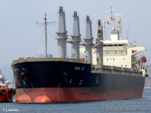
Vessel Ken Ei IMO: 9538983, MMSI: 354162000 Bulk Carrier
UTC, 47.99452, 164.03023, course: 110, speed: 11
2026-01-22 23:24:08 UTC, 47.20704, 167.73886, course: 107, speed: 11.2
Live AIS position:
UTC. 140 nm SW of Trakovice),
updated 2026-01-22 23:24:08 UTC.
Find the position of the vessel Ken Ei on the map. The latter are known coordinates and path.
marine traffic ship tracker show on live map
The current position of vessel Ken Ei is 47.20704 lat / 167.73886 lng. Updated: 2026-01-22 23:24:08 UTCCurrently sailing under the flag of Panama
Ken Ei built in 2013 year
Deadweight:
37056 tDetails:
Last coordinates of the vessel:
UTC, 48.12889, 163.36041, course: 108, speed: 11.7UTC, 47.99452, 164.03023, course: 110, speed: 11
2026-01-22 23:24:08 UTC, 47.20704, 167.73886, course: 107, speed: 11.2