 vesseltracker.com
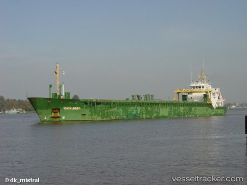
Vessel Ketlin IMO: 9342152, MMSI: 248622000 Multi Purpose Carrier
Live AIS position:
UTC. Near Bekkeri),
updated 2024-09-12 09:46:38 UTC.
Find the position of the vessel Ketlin on the map. The latter are known coordinates and path.
marine traffic ship tracker show on live map
The current position of vessel Ketlin is 59.46088 lat / 24.65157 lng. Updated: 2024-09-12 09:46:38 UTCCurrently sailing under the flag of Malta
Ketlin built in 2006 year
Deadweight:
5499 tDetails:
Last coordinates of the vessel:
2024-09-12 09:46:38 UTC, 59.46088, 24.65157, course: -1, speed: 0