 vesseltracker.com
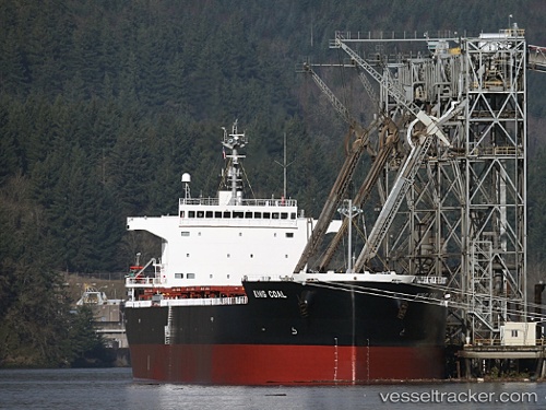
Vessel King Coal IMO: 9476939, MMSI: 355980000 Bulk Carrier
UTC, 37.04162, 126.16803, course: 259, speed: 0.1
UTC, 37.04298, 126.16814, course: 253, speed: 0.1
2026-01-27 12:18:08 UTC, 37.04113, 126.16854, course: 288, speed: 0.1
Live AIS position:
UTC. Near TAEAN-GUN),
updated 2026-01-27 12:18:08 UTC.
Find the position of the vessel King Coal on the map. The latter are known coordinates and path.
marine traffic ship tracker show on live map
The current position of vessel King Coal is 37.04113 lat / 126.16854 lng. Updated: 2026-01-27 12:18:08 UTCDetails:
Last coordinates of the vessel:
UTC, 37.03924, 126.16501, course: 354, speed: 0.1UTC, 37.04162, 126.16803, course: 259, speed: 0.1
UTC, 37.04298, 126.16814, course: 253, speed: 0.1
2026-01-27 12:18:08 UTC, 37.04113, 126.16854, course: 288, speed: 0.1