 vesseltracker.com
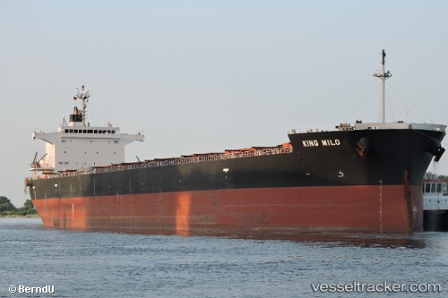
Vessel King Milo IMO: 9609512, MMSI: 373681000 Bulk Carrier
UTC, 25.14663, -116.47914, course: 300, speed: 12.3
UTC, 25.39961, -116.93231, course: 303, speed: 12.3
2026-01-27 11:55:01 UTC, 25.58793, -117.26859, course: 302, speed: 12.2
Live AIS position:
UTC. 186 nm SW of Morro Redondo),
updated 2026-01-27 11:55:01 UTC.
Find the position of the vessel King Milo on the map. The latter are known coordinates and path.
marine traffic ship tracker show on live map
The current position of vessel King Milo is 25.58793 lat / -117.26859 lng. Updated: 2026-01-27 11:55:01 UTCDetails:
Last coordinates of the vessel:
UTC, 25.00063, -116.23312, course: 305, speed: 12.3UTC, 25.14663, -116.47914, course: 300, speed: 12.3
UTC, 25.39961, -116.93231, course: 303, speed: 12.3
2026-01-27 11:55:01 UTC, 25.58793, -117.26859, course: 302, speed: 12.2